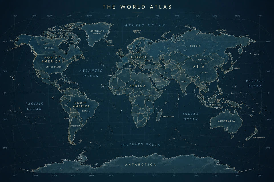
Match artwork you already love
Use a favourite print as the visual reference. Carry its colours, contrast and lettering into a new world map. A dark reference stays dark; a pale reference stays pale.
3 FOR 2 ON CANVAS PRINTS · FREE EXPRESS DELIVERY

A FAMILIAR WORLD. YOUR OWN PALETTE.
Bring the colours of your room into a refined atlas. Explore pale watercolour and rich navy styles, then create a map that sits naturally beside your favourite artwork and travel memories.
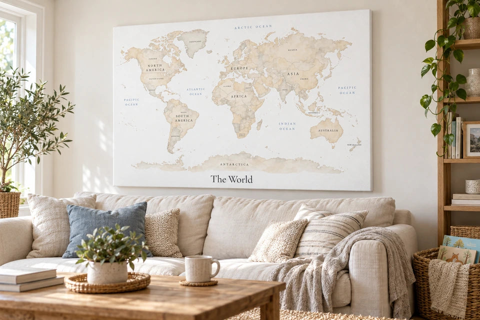
Choose pale watercolour for a quiet room or rich navy for deeper contrast. Download a favourite example free, or use an editable prompt with your own reference artwork to create a map that belongs in your home.
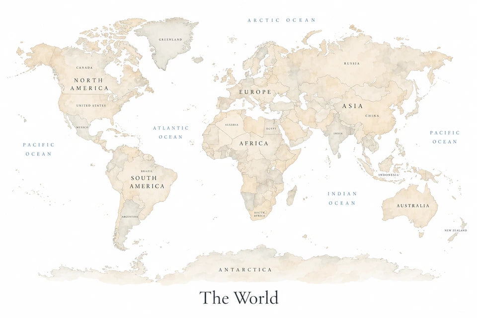
Pale watercolour land and delicate blue lettering sit comfortably beside cream, oak and soft neutral fabrics.
This downloads the pictured example, not a newly personalised result.
MAKE YOUR OWN VERSION
Image to attach
Attach the pale map example shown here, or another pale map, for neutral colours and airy composition. This prompt specifically keeps white oceans and pale land.
Personalise the prompt below, then use it in your image tool to create your own map.
Use my attached map as a visual reference for its pale neutral colours and airy composition.
Create one original, sophisticated world-map artwork for an adult living room or study, using restrained watercolour and delicate cartographic linework.
Show a single complete world map in the familiar flat arrangement: the Americas on the left, Europe and Africa near the centre, Asia and Australia on the right, and Antarctica below. Include Greenland and major islands. Use recognisable, geographically coherent coastlines.
Keep the background and oceans pure white. Paint the land in very pale sand, warm ivory, greige and soft taupe, with gentle tonal variation. Use small touches of dusty blue for ocean lettering and restrained muted ochre accents.
Use translucent watercolour, subtle pigment variation and fine warm-grey coastlines. Add lightly drawn country boundaries without crowding the map. Keep the finish elegant, spacious and quietly detailed.
Add readable continent and ocean names, plus a restrained selection of major country names in their correct locations. Use small, upright lettering with careful spacing. Place the title “The World” below the map in an elegant charcoal serif typeface.
Use a balanced 3:2 landscape composition with generous white margins. Keep the complete map visible.
Return one finished artwork. No circular hemispheres, enclosing oval, animals, balloons, aircraft, clouds, illustrated landmarks, stars, decorative icons, aged paper, saturated colours, logos, watermark, border, frame or room mockup.
Use a colour, a place or a memory as the thread that connects the pictures on your wall.
Use a favourite print as the visual reference. Carry its colours, contrast and lettering into a new world map. A dark reference stays dark; a pale reference stays pale.
Create a world map in the colours of a star map made for a meaningful date and place. The atlas borrows its appearance, without copying the sky or personal wording.
See the actual reference and result →A calm atlas can sit beside a companion print naming the places that matter to your family. Keep the personal wording separate from the map’s geography.
Choose pale land tones, delicate boundaries and restrained labels for a study or reading corner. Keep full margins and inspect the small lettering before printing.
Use the flat navy atlas as a starting point for a deeper palette with fine light linework. Its reference-led prompt retains the balance of light and dark.
Pair your world map with a favourite journey photograph and a small personalised word print. Choose three moments or places that belong together.
Keep your map as the anchor, add one of your own journey photographs and make a separate word print for your favourite places.
YOUR JOURNEY
PHOTOGRAPH
THE PLACES
THAT MADE US
Check your journey photograph → ·
Print at home and test the arrangement with paper templates, or order physical prints. 3 for 2 on canvas and poster prints: mix eligible physical prints; the lowest-priced base print is free. Frames and extras are charged separately. Digital files do not count as print items. Standard UK delivery is free; regional or oversize charges are shown in your basket.
Use your finished map as the style reference, then create a separate print with your favourite places.
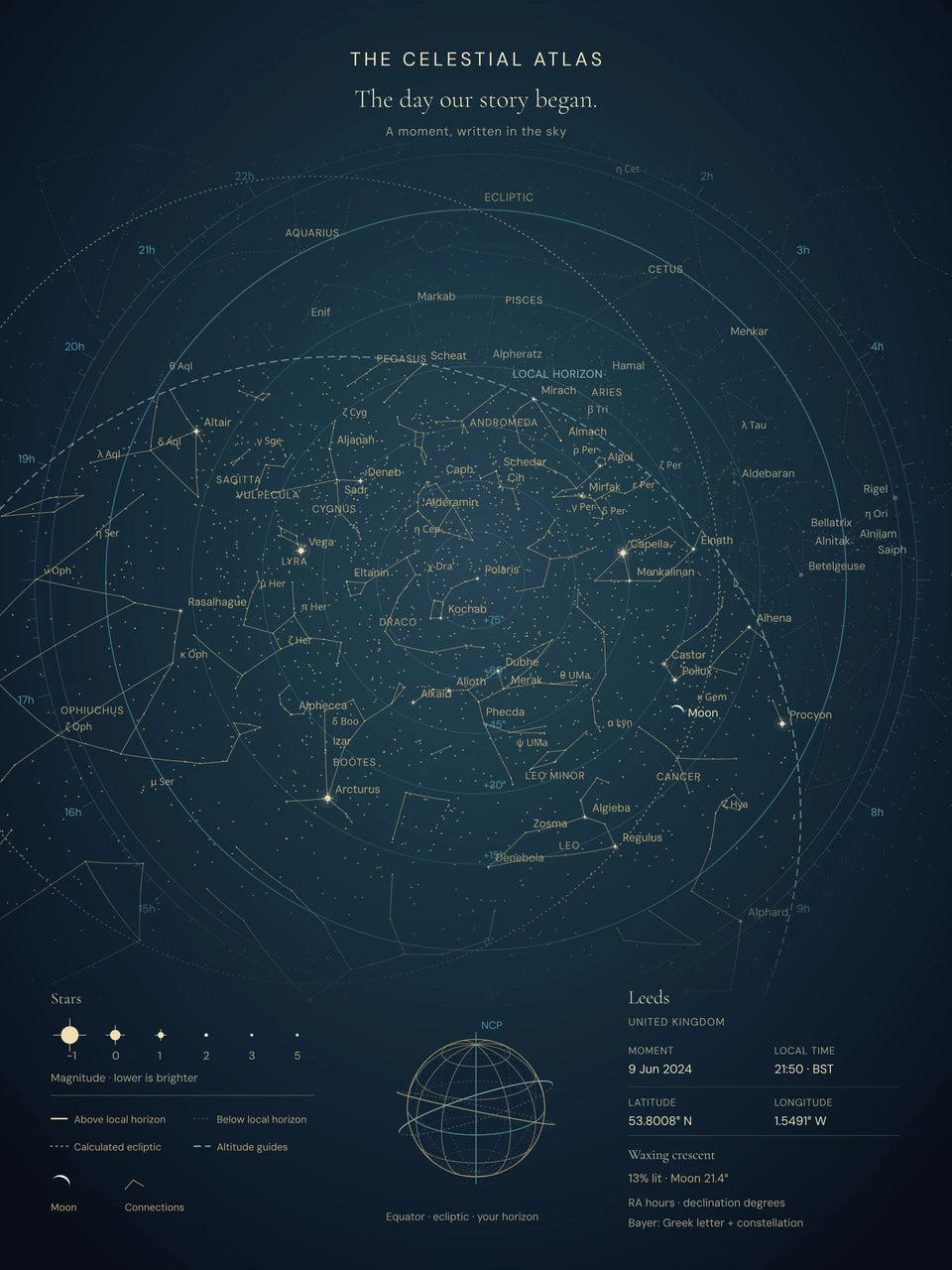
The star map above was created with our Star Map builder. Choose a meaningful date, time and place, then make it yours with your own wording. Order your finished design as a canvas print or poster, or save a free print-ready download.
The world-map example takes inspiration from its colours, fine linework and lettering. You can use a different reference image to create a map that fits your own room.
The free star-map download is made in the Star Map builder. It is separate from the world-map example on this page.
A4 landscape · image 297 × 198 mm · approximately 6 mm above and below, before printer margins.
Proportion preview only. This does not export, resize or change the original download. Your printer’s non-printable margins may make the image smaller. Dark maps keep the visible white paper margin.
Choose poster sizes, files and framing →
Browse picture frames at IKEA ↗
Available creator choices: canvas A5–A1; posters A5–A0. Check the current crop and quote; these ranges do not mean every image suits every size.
Download a favourite example, or use its prompt and stated references to create your own version.
Image to attach
Attach the pale map example shown here, or another pale map, for neutral colours and airy composition. This prompt specifically keeps white oceans and pale land.
Use my attached map as a visual reference for its pale neutral colours and airy composition.
Create one original, sophisticated world-map artwork for an adult living room or study, using restrained watercolour and delicate cartographic linework.
Show a single complete world map in the familiar flat arrangement: the Americas on the left, Europe and Africa near the centre, Asia and Australia on the right, and Antarctica below. Include Greenland and major islands. Use recognisable, geographically coherent coastlines.
Keep the background and oceans pure white. Paint the land in very pale sand, warm ivory, greige and soft taupe, with gentle tonal variation. Use small touches of dusty blue for ocean lettering and restrained muted ochre accents.
Use translucent watercolour, subtle pigment variation and fine warm-grey coastlines. Add lightly drawn country boundaries without crowding the map. Keep the finish elegant, spacious and quietly detailed.
Add readable continent and ocean names, plus a restrained selection of major country names in their correct locations. Use small, upright lettering with careful spacing. Place the title “The World” below the map in an elegant charcoal serif typeface.
Use a balanced 3:2 landscape composition with generous white margins. Keep the complete map visible.
Return one finished artwork. No circular hemispheres, enclosing oval, animals, balloons, aircraft, clouds, illustrated landmarks, stars, decorative icons, aged paper, saturated colours, logos, watermark, border, frame or room mockup.
Image to attach
Attach the navy Star Map shown below, or your own artwork as a visual style reference. Its palette, contrast and lettering guide the new map; its sky, date and personal text do not transfer.
Use my uploaded image as the visual reference for one original, sophisticated world-map artwork.
Let the uploaded image determine the colour palette, background colour, contrast, typography and overall visual character. Study its dominant colours, subtle accents and linework, then carry those qualities into the new artwork. Preserve its balance of light and dark: a dark reference should produce a dark map; a pale reference should produce a pale map. Do not replace its palette with a default beige or white scheme.
Create a refined terrestrial atlas with crisp, carefully drawn geography. Translate the reference’s visual style into coastlines, country boundaries, map labels and restrained cartographic details. Use the reference for its appearance, without reproducing its original subject, wording or layout.
Show one complete, continuous flat world map in the familiar arrangement: the Americas on the left, Europe and Africa near the centre, Asia and Australia on the right, and Antarctica below. Include Greenland, Madagascar, Japan, Indonesia, New Zealand and other major islands. Keep continent shapes, relative positions and coastlines geographically coherent.
Make the world map the dominant subject. Use a landscape 3:2 composition with generous margins and breathing room around the outer coastlines. Keep the background and oceans coordinated with the uploaded reference.
Draw coastlines and country boundaries with very fine, precise lines using suitable colours from the reference. Give neighbouring countries subtle tonal differences within that palette. Add a delicate latitude-and-longitude grid only if it suits the reference’s visual language.
Use elegant, legible atlas typography inspired by the reference. Label continents and oceans clearly, with smaller, carefully placed labels for major countries. Keep spelling correct and avoid crowded or overlapping text.
Add the title “THE WORLD ATLAS” in a restrained position, styled to match the artwork.
The result should feel like a beautifully designed contemporary atlas print: mature, balanced and detailed. No circular hemispheres, globes, inset maps, constellation diagrams, cartoon illustrations or unrelated decorations.
Image to attach
Attach an image whose palette, contrast and visual style you want to carry across. A dark reference should stay dark; a light reference should stay light.
Use my attached navy Atlas star-map artwork as the only visual style reference. Translate its deep navy palette, restrained warm lettering, fine linework and quiet chart structure into one sophisticated world-map artwork.
Create a complete world map in a traditional oval atlas projection. Show recognisable, geographically coherent continent silhouettes and carefully drawn coastlines, including Greenland, major islands and Antarctica. Keep all land masses comfortably inside the map.
Use a deep midnight-navy background with a subtle, muted slate-blue lift towards the centre. Render the land in slightly lighter blue, with fine warm-cream coastlines and restrained ochre accents. Add a delicate blue latitude and longitude grid that remains secondary to the geography.
Use a balanced 3:2 landscape composition. Make the map large and clearly readable, with generous open space around its perimeter.
Above the map, place the title “THE WORLD ATLAS” in modest, widely spaced uppercase lettering. Add correctly positioned continent and ocean names in small, readable warm-cream type. Keep the typography consistent and restrained, with enough contrast to read comfortably.
Make the artwork feel like a beautifully composed cartographic print, suitable for an office, living room or games room. Use crisp lines, controlled colour and a matte printed finish.
Return one finished artwork. No stars, constellations, planets, rockets, animals, illustrated landmarks, novelty symbols, slogans, invented coordinates, neon effects, metallic shine, logos, watermark, physical frame or room mockup.
The attached image is a visual style reference only. Generate the geographical world map described above, rather than reusing any astronomical chart content, captions or personal data.
Image to attach
Attach a Classic star-map artwork as a style reference only. Use your own wording when creating your star map.
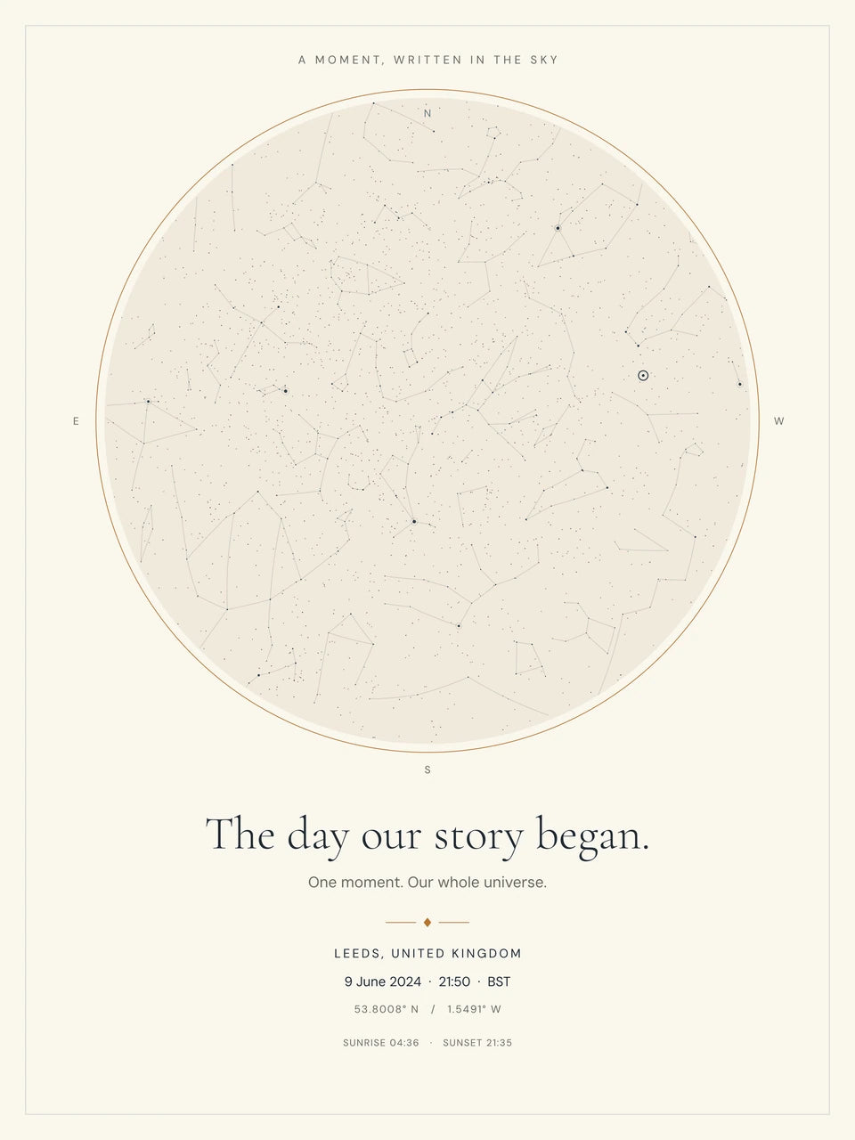
Use my attached Classic star-map artwork as the only visual style reference. Translate its palette, fine linework, typography and spacious composition into one sophisticated world-map artwork.
Create a traditional double-hemisphere world map: two equally sized circular maps arranged side by side, showing the western and eastern hemispheres. Use recognisable, geographically coherent coastlines. Include Greenland, major islands and Antarctica.
Use a warm ivory background, very pale greige land, fine slate-grey coastlines and delicate blue-grey latitude and longitude curves. Give each hemisphere a thin, muted ochre circular outline. Keep the colours flat and restrained.
Let the map occupy most of a balanced 3:2 landscape composition, with generous clear margins and comfortable space between the circles.
Add modest, readable continent and ocean names in charcoal-grey lettering, positioned correctly and kept clear of coastlines. Below the maps, include the single title “The World Atlas” in an elegant serif typeface, reflecting the typography of the reference.
Make the finish precise, calm and refined, suitable for a living room, study or office. Keep the geographical detail clear without making the artwork crowded.
Return one finished artwork. No stars, constellations, astronomical symbols, animals, illustrated landmarks, decorative icons, romantic captions, dates, coordinates, distressed textures, metallic shine, logos, watermark, physical frame or room mockup.
The attached image is a style reference only: generate the geographical world map described above, rather than reusing the star-chart content.
Attach your approved original. This prompt requires file-processing tools; it is not an image-generation request.
No. Downloading and using a file at home is useful on its own. YI2C printing is optional.
The reference-based examples state what to attach beside their prompt. The paper-cut, wooden, landmark, labelled explorer and prehistoric examples are text-only.
These are decorative AI-created interpretations. Coastlines, borders, labels, landmark positions and prehistoric details can be inaccurate. Use a reliable atlas or teaching resource for factual geography.
No. Results can vary. Keep the approved original if you want that exact picture, or attach it when requesting a focused edit.
No. It is metadata relating pixels to a physical size. The original detail, enlargement and intended print size still matter.
Use the separate original map download. The room images illustrate a display idea and are not artwork files or photographs of a tested finished product.


